Welcome to the Museum - where History Rules!
11/18/2017 - Tracing the Settlement of Howard County, MD V1.0.0
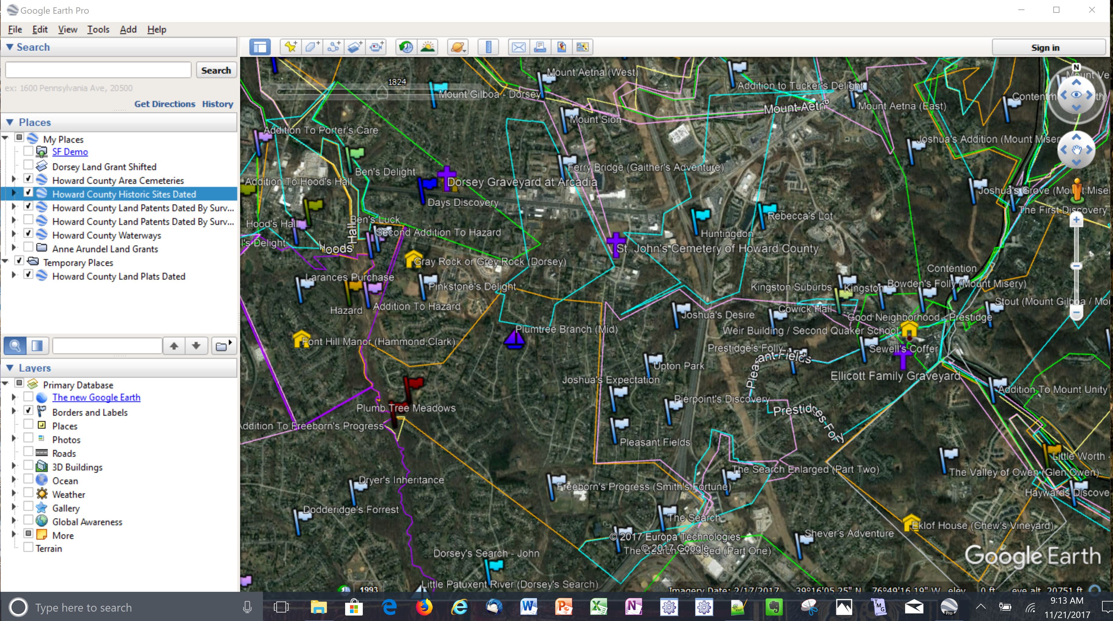
I am providing documentation of my research, including an Excel workbook with extracted information from the land patents, and Google Earth data files showing relevant locations and land patents associated with the settlement of Howard County. After the data files are opened in Google Earth, placemarks, plats, historic sites, cemeteries, and waterways will display as shown below. Start by reading the pdf file below to learn more about how the files were created and how to load the .kml files into Google Earth, then download the zip file to a safe location. None of these files are executable but always defend against hacking!
- Tracing the Settlement of Howard County, MD pdf file
- Tracing the Settlement of Howard County, MD zip file
See the complete list of files at Howard County Files
View a summary list of the land patents at Howard County Land Patents
3/29/2024 - Tracing the Settlement of Anne Arundel County, MD V3.0
I have finished platting the land patents for what is currently Anne Arundel County. Due to support for the free web server app platplotter.appspot.com having been suspended, I no longer have a way to edit my existing plats or create new ones, so I am suspending any further work on this project. Hopefully what I have will still be helpful and I will continue to answer emails and provide what support I can.
See the complete list of files at Anne Arundel County Files